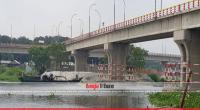
The mighty Padma River has eroded over 66,000 hectares or 256 square miles of land in the last 51 years, according to the Earth Observatory.
According to the online publishing outlet for NASA, hundreds, sometimes thousands, of hectares of land erode and fall into the Padma River every year.
“Since 1967, more than 66,000 hectares (256 square miles) have been lost—roughly the area of Chicago,” says the report published in August.
Satellite imagery shows how the river has been transforming in shape, size, and location from 1988 to 2018. The images were acquired by the Thematic Mapper on Landsat 5 (1988) and the Operational Land Imager on Landsat 8 (2018).
All images were acquired in January and February, during the dry season.
“For decades, the Padma River has meandered, twisted, and weaved in different shapes through central Bangladesh,” the report ‘The Shape of Erosion’ added.
Each zigzag and turn tells a geologic story of the region, such as a large flooding event or the opening of a nearby dam.
The upper section of the Padma—the Harirampur region— has experienced the most erosion and shows the most notable changes. The river has become wider at this section by eroding along both banks, although most activity occurred on the left bank, the report observes.
Using topographic, aerial, and satellite imagery, scientists found that the left bank shifted 12 kilometers towards the north from 1860 to 2009 and developed a meandering bend. The river left a scar where the water once flowed, as can be seen in the 2018 image.
The Observatory says, generally erosion is greatest on the outside of the river bends, where several processes can influence the land deterioration: changes in river flow, land masses moving downslope, and vegetation wearing away where the river meets the land.
The middle sections of the Padma River tend to experience low rates of erosion.
Erosion rates vary over time with the magnitude of the flood flow and the type of bank material. In 1998, a large flood rose over these banks, exacerbated by the opening of the Farakka barrage (dam) in India.
The Padma also has a large sand-bed, which is easily erodible. From 1998-1999, the erosion rate peaked at 3,120 hectares (12 square miles) per year.
In recent years, Padma’s erosion rate has decreased. It has slowed as the meandering bends disappeared due to sedimentation and chute cutoff—when the water flows across the land instead of following the curve of the river, the Earth Observatory report concluded.
In just over half a century, the mighty Padma river has eroded more than 66,000 hectares or 256 square miles of land area, the Earth Observatory says.
Every year, hundreds, sometimes thousands, of hectares of land erode and fall into the Padma River, according to the online publishing outlet for NASA.
“Since 1967, more than 66,000 hectares (256 square miles) have been lost—roughly the area of Chicago,” said the report published recently.
“For decades, the Padma River has meandered, twisted, and weaved in different shapes through central Bangladesh,” the report added.
Each zigzag and turn tells a geologic story of the region, such as a large flooding event or the opening of a nearby dam.
“These events can lead to intense erosion along the banks of the river, displacing farms, homes, and even lives,” the Earth Observatory added.
Satellite imagery shows how the river has been transforming in shape, size, and location from 1988 to 2018. The images were acquired by the Thematic Mapper on Landsat 5 (1988) and the Operational Land Imager on Landsat 8 (2018).
All images were acquired in January and February, during the dry season.
The upper section of the Padma—the Harirampur region— has experienced the most erosion and shows the most notable changes. The river has become wider at this section by eroding along both banks, although most activity occurred on the left bank, the report observes.
Using topographic, aerial, and satellite imagery, scientists found that the left bank shifted 12 kilometers towards the north from 1860 to 2009 and developed a meandering bend. The river left a scar where the water once flowed, as can be seen in the 2018 image.
In general, the Observatory says, bank erosion is greatest on the outside of the river bends, where several processes can influence the land deterioration: changes in river flow, land masses moving downslope, and vegetation wearing away where the river meets the land. The middle sections of the Padma River tend to experience low rates of erosion.
Erosion rates vary over time with the magnitude of the flood flow and the type of bank material. In 1998, a large flood rose over these banks, exacerbated by the opening of the Farakka barrage (dam) in India.
The Padma also has a large sand-bed, which is easily erodible. From 1998-1999, the erosion rate peaked at 3,120 hectares (12 square miles) per year.
In recent years, Padma’s erosion rate has decreased. It has slowed as the meandering bends disappeared due to sedimentation and chute cutoff—when the water flows across the land instead of following the curve of the river, the Earth Observatory report concluded.
 National
41179 hour(s) 32 minute(s) ago ;
Afternoon 02:26 ; Saturday ; Jun 28, 2025
Over 256 sq miles lost to Padma in 51 years
Send
Bangla Tribune Desk
Published : 04:30, Sep 16, 2018 | Updated : 04:30, Sep 16, 2018
Published : 04:30, Sep 16, 2018 | Updated : 04:30, Sep 16, 2018
0 ...0 ...
/zmi/
Topics: Top Stories
- KOICA donates medical supplies to BSMMU
- 5 more flights to take back British nationals to London
- Covid19: Rajarbagh, Mohammadpur worst affected
- Momen joins UN solidarity song over COVID-19 combat
- Covid-19: OIC to hold special meeting
- WFP begins food distribution in Cox’s Bazar
- WFP begins food distribution in Cox’s Bazar
- 290 return home to Australia
- Third charter flight for US citizens to return home
- Dhaka proposes to postpone D8 Summit
Unauthorized use of news, image, information, etc published by Bangla Tribune is punishable by copyright law. Appropriate legal steps will be taken by the management against any person or body that infringes those laws.
Editor: Zulfiqer Russell
Publisher: Kazi Anis Ahmed
Bangla Tribune is one of the most revered online newspapers in Bangladesh, due to its reputation of neutral coverage and incisive analysis.
F R Tower, 8/C Panthapath, Shukrabad, Dhaka-1207 | Phone: 58151324; 58151326, Fax: 58151329 | Mob: 01730794527, 01730794528